Part 107 · Course opens soon
The easiest way to learn what every drone pilot needs to know.
Airspace, charts, weather and the Part 107 rules, in short visual lessons that get you ready for the FAA drone pilot knowledge test, and for every job you fly after it.
What we’re building
A course that makes the hard parts obvious.
The rules themselves are short. What trips people up is the chart, the numbers and the wording. So that’s where we start.
- 01
One idea at a time
Every lesson starts from one real question, like “Can you fly here?”, and answers it in a minute or two. No 40-minute lectures.
- 02
Shown, not recited
Airspace rises off the chart as glass at its real heights, so the numbers on a sectional finally mean something you can picture.
- 03
Exact, with the source
Every answer cites the rule it comes from, like §107.51(b). No guesswork, no hype, nothing to unlearn later.
- 04
Practice like the real test
Timed practice tests with 60 questions, the same as the FAA knowledge test, and an explanation for every answer.
See how it works
One question, the way the course teaches it.
A chart question like the ones on the test. Pick an answer.
- Solid magenta: Class C
- Blue: airport with a control tower
- Ground elevation, ft above sea level
- Tower: top above sea level (height above ground)
Try one · Part 107 · Airspace
Can you fly here?
Your client’s roof is in Cedar Bend. There’s a big airport 8 miles away.
C. Yes, up to 400 ft.
No ATC authorization needed.
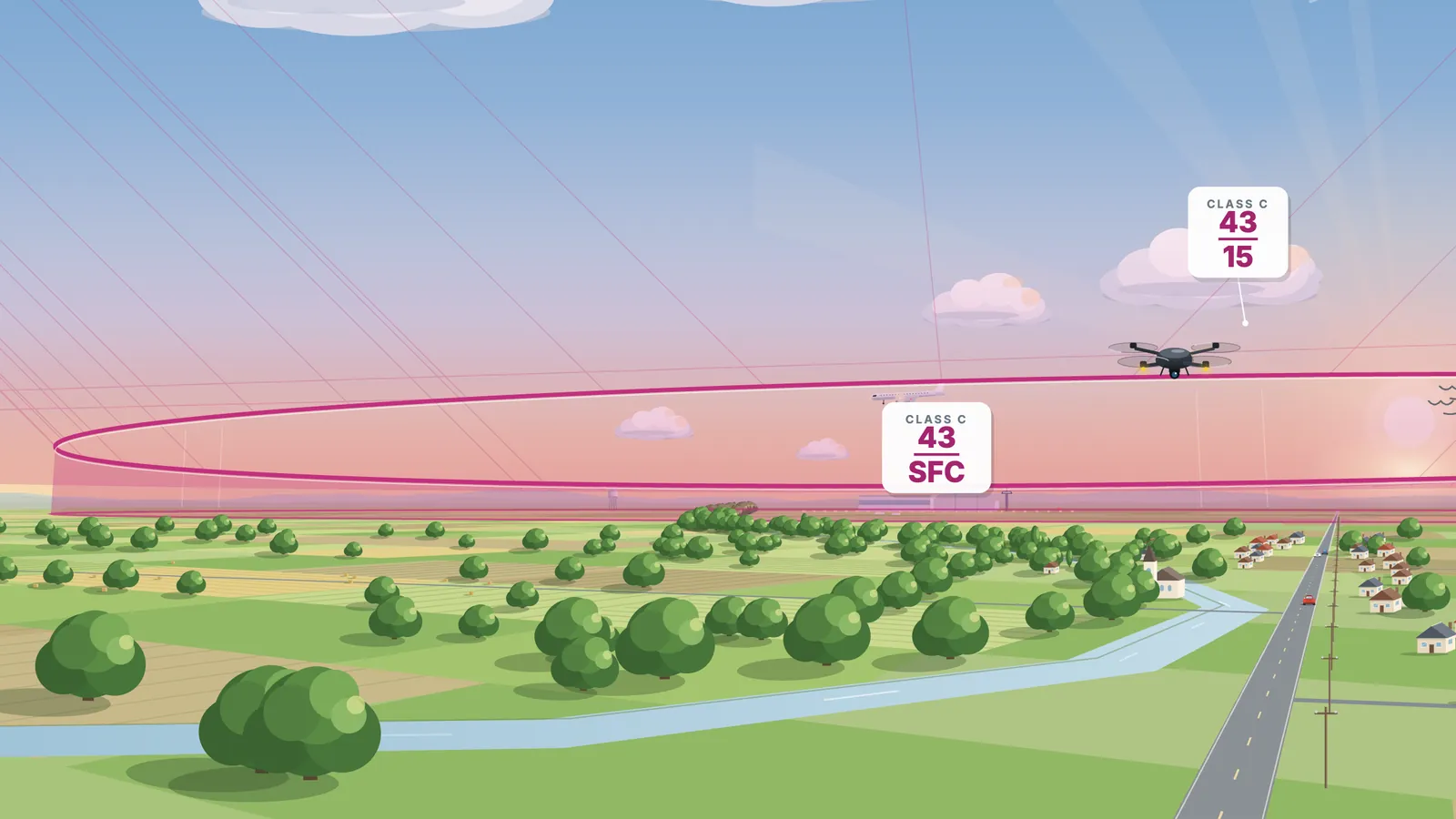
Each label is ceiling over floor, in hundreds of feet above sea level (SFC means the surface). Under the outer ring, 43 over 15 puts Class C from 1,500 feet up to 4,300 feet MSL. The ground here is 340 feet, so the floor is 1,160 feet above you. You may fly up to 400 feet, so you stay in the airspace below the shelf, where Part 107 needs no ATC authorization.
- Floor · 1,500 ft MSL
- Ground · 340 ft MSL
- Gap · 1,160 ft
- Your limit · 400 ft
- §107.41 · §107.51(b)
- Side view · not to scale
The bottom number is the floor.
What you’ll learn
Everything on the Part 107 test. Nothing you don’t need.
-
Airspace
Classes B, C, D, E and G, what the rings and shelves mean, and when you need ATC authorization before you fly.
Read: Flying under a Class C shelf -
Reading the chart
Sectional chart symbols, ceiling-over-floor labels, special use airspace, obstacles and the airport data you need.
Read: Flying under a Class C shelf -
The Part 107 rules
400 feet, 100 mph, visual line of sight, flying at night, over people and over moving vehicles, and what to report.
Read: The Part 107 test in 2026 -
Weather
METARs and TAFs, cloud clearance and visibility, and how heat, height and humidity cut your drone’s performance.
-
Airport operations
Traffic patterns, runway numbers and radio calls, so you know where other aircraft are and who gives way.
-
Your certificate
The knowledge test, the application, registration and Remote ID, and the free recurrent training every 24 months.
Read: How to get your Part 107 certificate
Who it’s for
Flying for work? You need Part 107.
In the US, flying a drone for any business purpose, paid or not, falls under Part 107, and the pilot in command needs a Remote Pilot Certificate. Airspace Class is built for people who fly for a living.
Do you need a license for your job?- Real estate photos
- Roof inspections
- Insurance claims
- Farms and crops
- Surveys and mapping
- Film and events
Free guide
Start learning now.
While the course is being built, the guide answers the questions we hear most. Each one cites its sources.
- Your certificate How to get your Part 107 certificate: every step, the cost and the wait Get an FTN in IACRA, pass the 60-question Part 107 test (about $175, 70% to pass), apply in IACRA, then register your drone. Every step, sourced. Read the guide
- The test The Part 107 test in 2026: format, passing score and the new chart questions 60 questions, 2 hours, 70% to pass. Since October 26, 2026 the Part 107 test can show current sectional charts that aren’t in the supplement. Read the guide
- Airspace Can you fly a drone under a Class C shelf? How to read the numbers Yes, below the shelf floor. Read the bottom number (hundreds of feet MSL), subtract the ground, and compare it with your 400 ft limit. Read the guide
- Flying for work Do you need a drone license to fly for work? Real estate, roofs, farms and more Yes. Any drone flight that isn’t purely for fun falls under Part 107, paid or not. Here is what that means for real estate, roofing, farms and more. Read the guide
Opening soon
Be the first in when the course opens.
One email when it’s ready. That’s all.